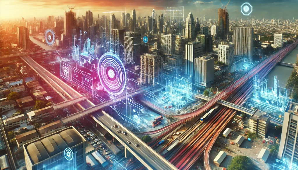
The framework of hard assets is a crucial component in building modern cities. While transportation system networks and other public service systems are components of a working urban infrastructure model, the way it’s thought out in the components of infrastructure creates how a city works. Planning and executing new infrastructure is a complex process that must satisfy all stakeholders, think through regulatory concerns, and ultimately assess sustainability issues. This is where infrastructure rendering provides a real advancement in urban planning and development. It takes complicated designs and technical models of infrastructure and returns them into visualizations that are attractive, digital representations. These visualizations allow architects, urban planners, and developers to discuss their ideas with stakeholders, which better facilitates the discussions about the timing of the project design process. In the blog post, we will concentrate on productive urban planning visualization in the three-dimensional rendering process and how those visualizations contribute to added value in infrastructure development.
What Is Infrastructure 3D Rendering?
Infrastructure rendering is essentially generating 3D photorealistic visuals of large-scale urban projects. Unlike the conventional blueprints and 2D plans of infrastructure, once a time-consuming process, 3D rendering makes the infrastructure designs more accessible to not only the technical teams but also those who do not have a high level of technical knowledge.
This technology allows professionals to visualize a variety of infrastructure components, including:
- Roads and highways
- Bridges and tunnels
- Railways and metro stations
- Water and sewage systems
- Public spaces and city layouts
By leveraging 3D rendering for infrastructure, stakeholders can assess design feasibility, detect potential issues, and refine project details to ensure optimal results before construction begins.
Why 3D Rendering Is Essential for Infrastructure Projects
3D rendering has emerged as a game-changer in infrastructure development. It is a powerful tool that benefits architects, urban planners, developers, and decision-makers alike. Here are some of the key advantages of urban planning visualization through 3D infrastructure rendering:
1. Enhanced Communication with Stakeholders
Infrastructure projects often involve a variety of stakeholders, including governmental entities, financiers, engineers, and members of the public. Graphic renderings of infrastructure are simply designed, engaging, complementary, clear, and informative visuals that explain technical topics more plainly than blueprints and complex diagrams. Stakeholders can visualize the project’s scale and impact by actively engaging with detailed renderings rather than passive contemplation of drawings and documents.
2. Accurate Planning and Problem Detection
Infrastructure projects are typically the result of combining multiple systems, materials, and spatial considerations. Without adequate visualization, design conflicts, bad configurations, or implications caused by construction challenges can arise, leading to extensive delays and/or exorbitant change orders. Utilizing 3D rendering for infrastructure can assist urban planners and engineers with discerning and resolving spatial conflicts earlier in the process. For example, in the design of a metro station, 3D infrastructure rendering can identify whether or not underground utilities will disturb the planned tunneling. Identifying the conflicts will allow for remediation prior to construction in order to avoid schedule delays and excess costs.
3. Environmental and Social Impact Analysis
In today’s world of urban development, sustainability is increasingly becoming a major consideration, and urban planning visualization is essential in evaluating environmental and social impact before the development begins. Infrastructure rendering is not just a mechanism for publicizing development—it actually gives decision-makers the opportunity to assess unintended negative effects. For instance, an infrastructure rendering project provided evidence of the environmental impact related to the redevelopment of a golf and tennis facility in California. The big green footprint of the commercial redevelopment provided obvious information on how the redevelopment would eliminate all green spaces, reducing habitat and recreational areas for the public. The local authorities reconsidered the project approval based on what was evident from the 3D rendering for infrastructure.
Key Benefits of Using Infrastructure 3D Rendering
Now that we have explored the fundamental role of infrastructure rendering, let’s dive deeper into the specific advantages of using this technology in urban planning and development.
1. Improved Project Approval Rates
Obtaining approvals for large infrastructure projects can be difficult because of stringent regulations, environmental sensitivity, and public opposition. However, using 3D rendering for infrastructure impacts makes the approval process efficient and to approve.
- Government officials can more effectively approve zoning compliance and safety measures.
- Investors become more confident in the project’s feasibility.
- The public can more readily understand the effects of new development on their communities, leading to a decrease in resistance and a higher likelihood of support.
2. Cost and Time Efficiency
Errors made in planning infrastructure can result in expensive re-planning and construction delays. When urban planning visualization can minimize risks by identifying potential issues in an urban plan before construction begins.
- Developers can adjust plans based on stakeholder feedback in real-time.
- Engineers can identify design layout flaws and material usage flaws.
- Project managers can improve coordination of several teams, to eliminate miscommunications.
3. Better Collaboration and Workflow Integration
Infrastructural projects require cooperation from multiple professionals including architects, engineers, urban planners, environmental professionals, and marketing team(s). 3D rendering for infrastructure serves as a mutual visual reference point, allowing the different professions to easily communicate with one another.
Types of 3D Rendering for Infrastructure
Depending on the purpose, audience, and complexity, infrastructure projects utilize different types of urban planning visualization techniques. Let’s explore the main types:
1. Non-photorealistic technical Visualization
This kind of rendering emphasizes the structural and engineering elements as opposed to appearance. This is beneficial for assessing zoning layouts and underground systems and for technical specifications. Example: Cutaway rendering, which is a technique for rendering where the structure is cut away at certain locations to show the internal workings, such as plumbing or electrical systems.
2. Photorealistic Rendering
Photorealistic infrastructure rendering provides high-detail visuals for stakeholder presentations and public communication. The most commonly used techniques include:
- Site Plan Rendering: A top-down view of the entire infrastructure project.
- Bird’s-Eye View: Displays the project from an elevated perspective to show its integration with the surroundings.
- Photo-Matching: Combines 3D graphics with real site photographs to create ultra-realistic visualizations.
3. 3D Animations
For transportation and dynamic infrastructure projects, animations are essential. These can illustrate traffic flow, pedestrian movement, and environmental changes over time, helping decision-makers assess project viability.
How to Choose the Right 3D Visualization Partner
Selecting the right 3D rendering company is essential for ensuring high-quality infrastructure rendering. Here are key factors to consider:
1. Expertise in Infrastructure Projects
Not all 3D rendering studios specialize in urban planning visualization. Choose a company with experience in roads, bridges, transportation hubs, public spaces, and large-scale developments.
2. Software and Technology Proficiency
Look for a firm proficient in industry-leading software such as CAD, Unreal Engine, and rendering farms for efficient processing of complex projects.
3. Well-Structured Workflow
A reliable rendering company should offer:
- Clear project timelines and milestone tracking
- Transparent communication channels
- Defined revision policies
- Dedicated project managers
4. Scalability of the Team
Large infrastructure projects require scalable 3D teams capable of handling multiple tasks simultaneously. A well-equipped team ensures high-quality results without delays.
5. Proven Track Record and Portfolio
A strong portfolio showcasing diverse infrastructure projects is a sign of expertise. Look for firms that have successfully completed large-scale 3D rendering for infrastructure projects.
6. Positive Client Reviews
Client feedback provides valuable insights into a company’s professionalism and reliability. Check independent reviews on multiple platforms to assess the firm’s reputation.
Conclusion
Infrastructure rendering is a useful approach to facilitating urban planning and urban development; By utilizing 3D rendering for infrastructure applications, architects, planners, and developers can not only better visualize large-scale projects of this nature, but also notice areas where modification may be necessary, and convey their design to their project partners. All of this can lead to better rates of approval and collaboration. Urban planning visualization helps promote that infrastructure projects are developed efficiently and sustainably. We can disrupt urban development with an innovative infrastructure rendering partner that can create smarter, more connected, and visually appealing future cities.
Read More: 5 Key Advantages of Commercial Renderings